
Fast
Process thousands of kilometers of roadway data in hours, not weeks. Our automated pipeline delivers rapid turnaround for critical infrastructure reporting.
See every roadside asset. Understand every road's condition. Turn street imagery into smarter decisions with AI.
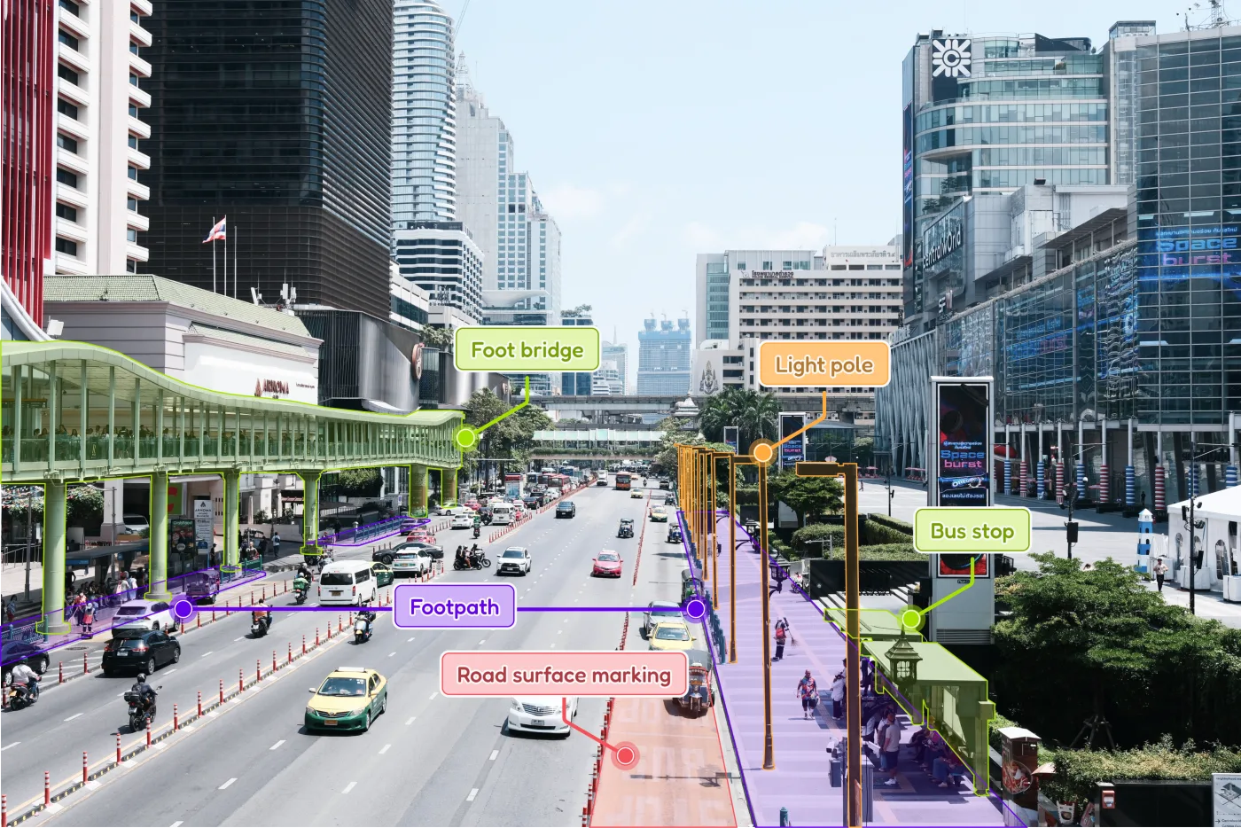
We turn the streets you see into the insights you need. Attrack brings together AI and mobile mapping scanning data into detailed digital asset inventories, helping cities plan maintenance with confidence.
Our mission is simple: make infrastructure management faster, more accurate, and more transparent. With a clear picture of what needs attention, every road maintenance investment can go further.
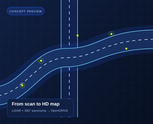
What we do?
Turn the roads you capture into maps you can build on. Attrack transforms LiDAR and 360° panorama scans into detailed HD maps in OpenDRIVE format, connecting real streets to your simulation and mobility workflows.
Use case 1 of 3: HD Map-ready
The modern choice for geospatial asset intelligence.
Process thousands of kilometers of roadway data in hours, not weeks. Our automated pipeline delivers rapid turnaround for critical infrastructure reporting.

Seamlessly integrate with existing GIS workflows and ERP systems. We support standard export formats like GeoJSON, CSV, and Shapefiles for maximum interoperability.

Hardware agnostic. Whether it's high-res survey cameras or standard mobile devices, our AI adapts to various input sources without sacrificing detection accuracy.
From Imagery to Insight: Our 3-Step AI Workflow
Uses Mobile Mapping to capture 360° panorama imagery, which are then securely uploaded to our platform.
Highest Quality: Utilises high-precision data from standard Mobile Mapping systems.
Our proprietary AI algorithms instantly "see," locate, classify, and geocode (attach GPS coordinates to) every identifiable asset, often assessing its current condition.
Fast & Accurate: Asset extraction is 5x faster and significantly cheaper than traditional manual methods.
Access the processed data instantly via our Web Viewer or export it in industry-standard GIS formats (Shapefile, GeoJSON) for direct use in your existing management systems.
Ready-to-Use: Immediate insights for maintenance planning, budget allocation, and reporting.
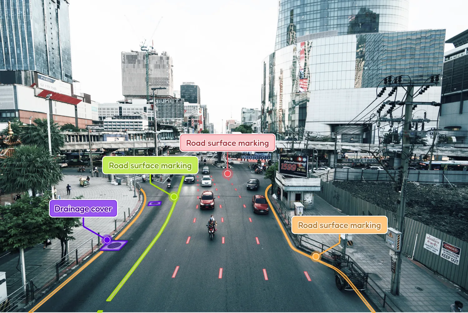
What our AI can track?
Our models are trained on diverse data to recognise, categorise, and report on the full spectrum of traffic and urban safety assets.